We start our first oceanographic campaign

Oceanographic vessel Vizconde de Eza.

This is the MEDITS-AUT campaign, the first of its kind to be carried out by a Catalan research group based at the Institut de Ciències del Mar (ICM-CSIC).

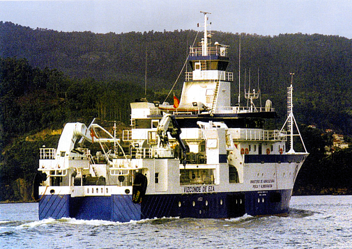
The campaign will be carried out on board the oceanographic vessel Vizconde de Eza and will cover the waters of Catalonia, Comunidad Valenciana, and part of Murcia over a period of 24 days.

The data will be collected following the Programa Nacional de Datos Básicos (PNDB) and will complement those from the MEDITS campaign, which is carried out annually by the Instituto Español de Oceanografía (IEO-CSIC).

Barcelona, 10 November 2025

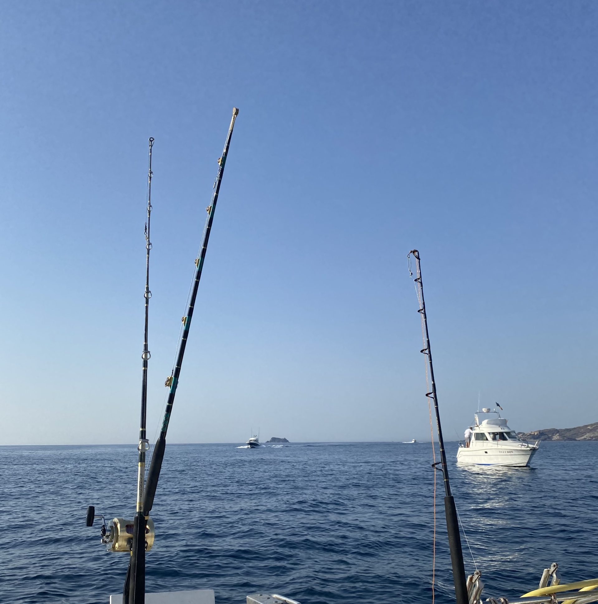
Next Monday, 17 November, around twenty scientists from the Institut Català de Recerca per a la Governança del Mar (ICATMAR) and the Institut de Ciències del Mar (ICM-CSIC) will board the oceanographic vessel Vizconde de Eza operated by the Secretaría General de Pesca, to launch, for the first time, a MEDITS campaign in autumn: the MEDITS-AUT25. These type of campaigns are usually conducted in spring, and replicating them at a different time of the year will provide a more accurate picture of the status of fishery resources in the western Mediterranean.

The campaign will last for 24 days and will cover the entire GSA 6, a geographical subarea established by the General Fisheries Commission for the Mediterranean (GFCM) which includes the western Mediterranean waters from Catalonia to Murcia. This initiative is made possible through a collaboration between ICATMAR and the Ministerio de Agricultura, Pesca y Alimentación and will become the first oceanographic campaign of this kind to be carried out by a Catalan research group. The main objective is to obtain complementary data to those collected during the MEDITS campaign conducted annually by the IEO-CSIC in spring, which are used to estimate the abundance and distribution of target species in bottom trawl fisheries.

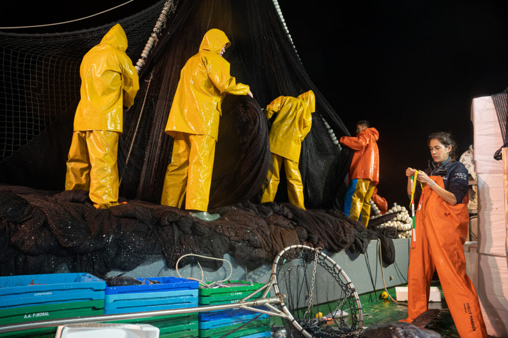
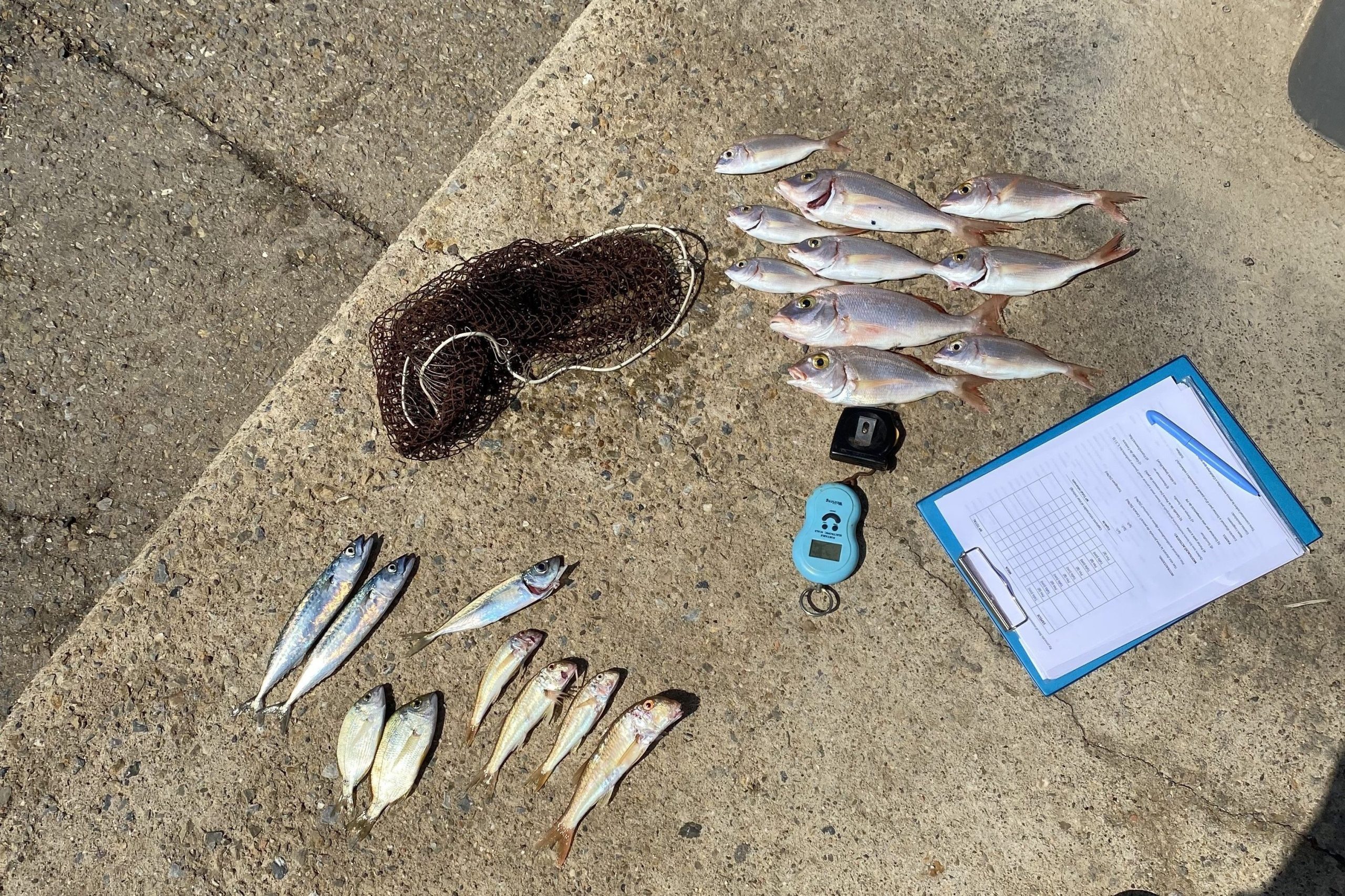
Following the MEDITS protocol, the campaign will carry out a minimum of 88 trawl hauls, covering the continental shelf and slope at depths ranging from 10 m to 800 m. In addition, oceanographic data will be collected from water masses, such as temperature and salinity, which will allow researchers to study their characteristics and changes over time.

The implementation of MEDITS-AUT25 will provide us with highly valuable information, as it will allow us to observe seasonal changes in the distribution of bottom trawl target species due to biological and ecological factors. Moreover, having two annual campaigns at different times of the year significantly increases the resolution of abundance and biomass indices for the analyzed species,” says researcher and campaign leader Joan Baptista Company.

The MEDITS campaign

The MEDITS campaign (Mediterranean International Trawl Survey) was launched in 1993 following a regulation by the European Council on the Common Fisheries Policy (CFP). The regulation urged Member States to carry out oceanographic surveys to obtain long-term series of scientifically robust data for the management and conservation of demersal species’ stocks—those associated with the seabed—in the Mediterranean. The data collected are incorporated into the Programa Nacional de Datos Básicos (PNDB).

Over the years, the program has evolved beyond the assessment of fishery resources to also include the study of marine communities and ecosystems, the identification of key habitats for species, and the analysis of marine litter, among other aspects. The information gathered during MEDITS campaigns is used by working groups of the Scientific, Technical and Economic Committee for Fisheries (STECF) and the GFCM to develop recommendations for fisheries management.

“Now, collecting data in autumn following this same protocol will allow us to gather information on early life stages of certain species that cannot be found in spring, such as the red mullet (Mullus barbatus),” notes ICATMAR researcher Marta Blanco.

Discover the new features of the fisheries data viewer

We are launching new features for the ICATMAR fisheries data viewer. From now on, you can explore the data from the purse seine sampling. Additionally, we have incorporated improvements in size frequency comparisons and reorganized the viewer to facilitate data exploration.

Fisheries data viewer for the purse seine fishing modlity.

The ICATMAR fisheries data viewer was launched in 2023, displaying data from bottom trawl sampling. Now, thanks to the viewer’s update it is possible, for the first time, to explore data from the purse seine modality. Just as was previously possible with bottom trawling, by clicking on one of the purse seine fishing operation on the map, you can view the catch composition of the selected fishing operation, indicating the biomass of the target species—sardines and/or anchovies—as well as other captured species. Additionally, through the integration of external data from Copernicus and EMODnet Seabed Habitats, you can also check the meteorological and oceanographic conditions at the time of the fishing and determine the type of marine habitat of the seabed where it was carried out.

Comparison of size frequencies by year of hake sampled from 2019 to 2023.

During the sampling for both modalities, whether onboard fishing vessels or in the laboratory, either all individuals or a subsample of individuals from all captured species are measured. This data provides valuable information about population structures, enabling the study of species size distributions, including their approximate size range and the proportion of individuals of each size. With the previous version of the viewer, it was already possible to examine the size distributions of sampled species, but the new version allows for comparisons of species size distributions by year, season, métier, and zone. Additionally, for the size distributions of commercial species, the minimum conservation reference size (MCRS) and the size of first maturity (L50: the size at which 50% of individuals are considered to have reproduced for the first time) of the selected species are now displayed.

In Catalonia, the two main fishing modalities in terms of revenue and catch volume are bottom trawling and purse seine fishing, respectively. Since 2019, ICATMAR has conducted samplings onboard bottom trawling vessels. Onboard sampling provides highly detailed information about all aspects of a fishing trip, enabling the identification of the total catch composition (including both commercial and discarded species) and the collection of location data for each fishing operation and the maneuvers performed. Conversely, purse seine sampling initially consisted of acquiring lots of sardines and anchovies (the two target species of this modality) from various fish markets along the Catalan coast. This type of sampling, the fish market sampling, provided limited information about the fishery. However, starting in 2022, purse seine sampling was also conducted onboard commercial vessels. This has made it possible to access previously unavailable information about the fishery, which, after more than two years of data collection, is now publicly accessible through the updated viewer.

Looking ahead, the fishing data viewer will continue to incorporate new updates to make the information gathered through ICATMAR’s various monitoring programs available to everyone. Soon, it will also be possible to explore data obtained from monitoring recreational marine fishing in Catalonia, which has been ongoing since 2020. Stay tuned!

The report on the state of marine recreational fisheries in Catalonia in 2023 is now available

You can now download the report State of Marine Recreational Fisheries in Catalonia 2023 in the Publications section

Marine recreational fishing is a non-professional activity practiced for leisure by approximately 350 million people worldwide. Despite being one of the most popular coastal leisure activities globally, there is a historical lack of knowledge about its impacts, as well as a general lack of data collection, sampling and assessment systems for the activity. For this reason, ICATMAR launched a continuous monitoring program for marine recreational fisheries in Catalonia in 2020. The goal of the program is to compile a time series of data on catches and species records to provide a reliable and robust information source for decision-making in potential management strategies.

In this report, which you can download from the Publications section, the results of the continuous monitoring of marine recreational fisheries in Catalonia conducted by ICATMAR during 2023 are presented, comparing them with the period 2020-2022. In the different sections, you will find, among others, indicators for the different fishing modalities practiced in the region, namely shore angling, boat angling, and spearfishing. Additionally, you can also download a drop-down summary with the main results of the report in Catalan.

Source: Marta Pujol-Baucells

Catalonia adds 20 permanent no-take zones to its marine protected areas

The creation of this marine protected areas network constitutes an unprecedented expansion of the Catalan coastline where demersal fishing is not allowed.

The new no-take zones total 462 square kilometers, which is roughly equivalent to the extension of Andorra.


Source: ICATMAR / Authors: José Antonio García del Arco & Joan Sala-Coromina

Catalonia has added this 2022 a total of 20 new marine protected areas banned to demersal fishing, i.e., fishing of species that inhabit the seabed. The total surface area of these zones is 462 square kilometers, which adds up to 283 times the previous protected area where this type of fishing was not allowed.

The creation of this new marine protected areas network is the result of a close collaboration between the Catalan fishermen’s guilds, the scientific sector, represented by the Institut Català de Recerca per a la Governança del Mar (ICATMAR) and the Institut de Ciències del Mar (ICM-CSIC) of Barcelona, and the Generalitat de Catalunya for more than three years.

“This measure will contribute to the recovery of ecosystems and marine species that are part of them,” celebrates the ICM-CSIC and ICATMAR researcher Laura Recasens.

The initiative is part of the Maritime Strategy of Catalonia, which is based on the co-management model, i.e. the active participation of all stakeholders involved in decision-making on fisheries management. However, the first steps were taken in 2013 by a group of fishermen from the Roses fishermen’s guild who decided to carry out the first closure of a fishing area. Later, in 2015, a scientific team from the ICM-CSIC began to study how this measure was contributing to the ecosystem’s recovery.

This first closure led to an increase in the abundance of juveniles and adults of commercial species, not only within the protected area, but also in adjacent areas. Therefore, researchers decided to extend the initiative to all the fishermen’s guilds in Catalonia until the current establishment of this network of 20 new marine protected areas along the entire coastline.

The Catalan model is also being implemented in other areas of Spain thanks to the collaboration between ICATMAR and the Spanish Institute of Oceanography (IEO) with the Spanish government’s Fisheries Secretariat.

A historic milestone

Alogether, the protected zones total 462 square kilometers, which is roughly equivalent to the surface area of Andorra.

“We value very positively the fact that, in order to carry out the implementation of this model in Catalonia, the different fishermen’s guilds have had to give up exploiting part of their fishing grounds, thus contributing to the protection of marine ecosystems,” states the ICM-CSIC and ICATMAR researcher Joan B. Company, who is convinced that the new measure will be very beneficial for the marine environment.

Because of the existence of this marine protected areas network, from January 2022 no demersal fishing activity will be allowed, which will favour the biodiversity recovery and the increase of the biomass of the species in these habitats, including those of commercial interest.

In this sense, ICATMAR and ICM-CSIC are committed to a monitoring and restoration program of exploited ecosystems to ensure a continuous gathering of quality scientific data to inform the administration’s decisions on fisheries management.